
Trail: Indian Oils Trail
Difficulty: Intermediate
Length: 10 km (there and back)
Ascent: 425 metres
Trailhead: At the west end of Sheep River Park west of Turner Valley on Hwy. 546. Four trailheads are available, the third providing the shortest, most direct route to the four-way junction (the start of the official trail).
1. Indian Oils parking lot about 800m from the four-way junction: The trail starts at the west end of the parking lot. Follow it west about 170m to a T-junction, turn north into a wooded region leading to the road in about 60m, then cross the road to Trailhead #2.
2. A small pull-out on the side of the road about 300m west of the Indian Oils parking lot (Trailhead #1) about 500m from the four-way junction: Follow the trail across the road along an old mining road where you will eventually descend into a small creek. Continue to the marked four-way junction and turn right to start the hike.
3. A small pull-out on the east side of the road, about 800m west of Indian Oils parking lot (Trailhead #1), about 200m from the four-way junction: Follow the road west for about 100m to a creek and turn right following the east bank to the marked four-way junction and go straight to start the hike.
4. Sheep River Falls Day use area about 500m from the four-way junction: At the end of the parking lot cross onto the highway, walk west along it for about 150m and arrive at a trail on the right side of the road. Follow it east (to your right), for about 350m until you arrive at the marked four-way junction and turn left to start the hike.
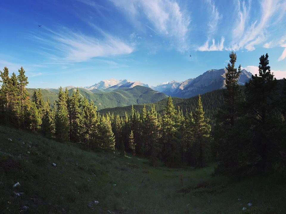
Trail Description: Follow the trail high above a creek through a pleasant mixed forest with a few wet areas along the way. The trail climbs through several switchbacks, some quite steep. You’ll get occasional glimpses of the surrounding hills and mountains, arriving at the first pass (summit) 2.2km from the junction with a bench to admire the surrounding beauty. Enjoy amazing views of Junction Mountain, Shunga-la-She, Mount Burns and Mount Hoffman, to name a few. To enjoy a more expansive view, climb the forested hill just north of the meadow. Beyond this point, the trail becomes heavily forested with some views. However, if you continue along for about 300m, a cairn to the right will point to a trail, 200-300ms long, leading to a small pond. This is an out and back trip, and unless you’re planning to use the Gorge Creek Trail at the end of this trail to connect elsewhere, turn back after the bench.
Recommended equipment: Microspikes for snowy and icy sections, poles and good season-appropriate hiking boots.
Reminder: Take adequate water, food and clothing in the event of sudden weather changes. Ensure someone knows where you’re going and when you’ll be back in the event you get lost or injured. Hiking alone is not recommended.

.png;w=120;h=80;mode=crop)

