
Black Diamond council is disputing Alberta’s new flood mapping study.
In a Jan. 20 meeting, council was presented with changes the Government of Alberta will be considering based on a study commissioned by Alberta Environment and Parks (AEP).
The new flood mapping would invalidate the mitigation measures, such as berms funded by the provincial government, in response to the 2013 flood.
Based on the new model from the Province, the measures intended to protect against a 1-in-100 year event would not be sufficient for a 1-in-20 year flood, according to the presentation by Town administration to council.
“We had significant concerns, so we pulled in our director of emergency management, our planning department, and our consulting engineers to have a meeting with AEP,” Black Diamond CAO Sharlene Brown said in the meeting.
She said the 1-20 interpretation will impact developments, how the town grows, and potentially personal property insurance values. The Town could potentially dispute the new evaluation.
Town planning manager Rod Ross echoed these concerns.
“When Alberta Environment released the flood mapping to the Town, we were surprised and concerned that the new mapping shows a significant portion of Black Diamond near the Sheep River being flooded in a 1-in-20-year event,” Ross said. “We had recently built berms we understood to be designed for a 1-in-100 year event.
“Initially we talked directly with Alberta Environment about these concerns and they stood by their mapping and modelling.”
Ross said the Town’s engineering consultants had a different take.
“We approached Urban Systems (the Town’s engineering consultants) to undertake a review of the model that they used and reviewed the maps and get a second opinion as to whether the mapping was realistic," Ross said. “Urban Systems undertook a model, they looked at it several different ways.
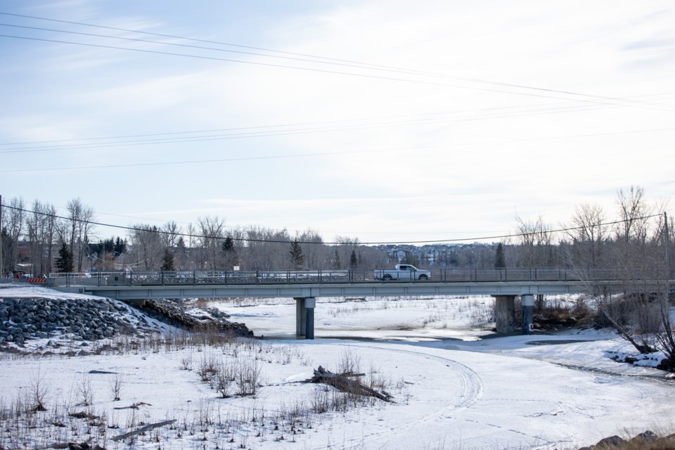
“They have some concerns they expressed with the modelling and mapping and recommended that Alberta Environment revisit some of their assumptions around modelling that they used in and around the Highway 22 Bridge specifically.”
Among the concerns stated in Urban Systems’ review summary, which was included in the Jan. 20 agenda package, were inaccurate modelling of flow and geometry regarding the bridge.
Ross said the Town’s response, based on its engineers’ analysis of the study, would be to identify the concerns to AEP and request it revisit its modelling and either confirm or change the mapping.
The council voted in the meeting to direct administration to submit its comments and concerns to the AEP regarding the flood study.
Mayor Ruth Goodwin said the new mapping could have direct repercussions for residents.
“I think that now, especially for all of those residents that happen to live within the 1-in-20 (area), they need to get active, they need to pay attention to this mapping,” Goodwin said in a phone interview. “Now's the time while they're consulting, and looking for input to significantly inundate them with your opinions, via email, by call, by letter, any means possible.
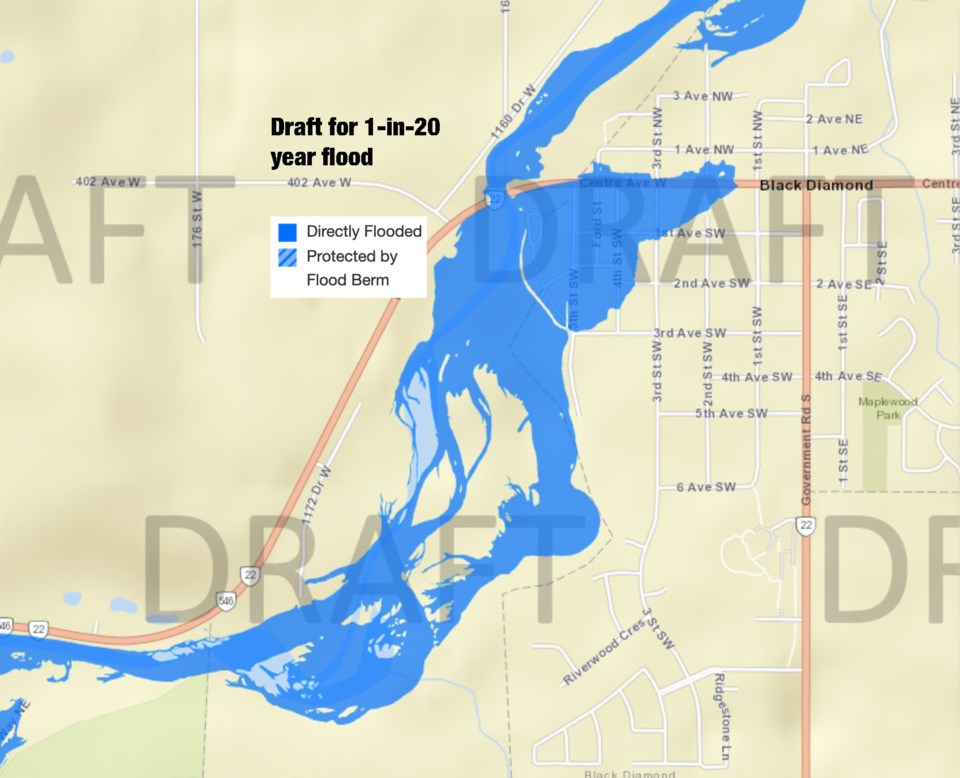 Proposed flood inundation mapping for a 1-in-20 year flood in Black Diamond based on a new study by Alberta Environment and Parks. Map from Alberta Environment and Parks
“We're doing our part by indicating very strongly that we have objections and where we see them.”
She continued saying the new mapping will affect insurance rates and the ability for residents to develop property.
“In the next year, if this is accepted by the provincial government, it will be near impossible to make any changes for a very long time,” Goodwin said.
She went on to say as Alberta Transportation will be looking at twinning Highway 22 through town in coming years, the potential widening of the area between each bank may negate or change the report’s findings.
Goodwin added the berms and mitigation measures, which were put in place after the 2013 floods based on engineering studies by the Province, were supposed to be sufficient with height to spare.
“They participated in the berm studies, as well as the engineering groups, and we were assured this would do us for a 1-in-100 (year flood).”
Goodwin wants AEP to qualify and explain its new mapping, or at least review it.
“I do believe that they should be accountable for this," she said.
The new flood mapping can be viewed at https://floods.alberta.ca and by selecting "Draft View" from the top left drop-down menu, or by clicking here.


