
OKOTOKS — Elma Street residents were relieved to see the Town consolidate parklands north of their homes.
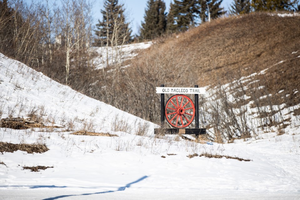
The land, located east of Northridge Drive between Elma Street and Mountain Street, where the Macleod Trail runs, was turned into an environmental reserve parcel at the Feb. 10 council meeting.
It was a relief to Elma Street resident Marion Bowen, who let out a quiet cheer of victory when council voted unanimously to consolidate and protect the lands.
“I’m definitely in favour,” she told council during the public hearing, adding she hadn’t wanted to see development there.
Her only question was why two lots, immediately adjacent to Northridge Drive, were not included in the parcel.
Okotoks senior planner Colin Gainer said the lots were acquired by Alberta Transportation as part of the right-of-way required to develop the highway on Northridge, and though they’re not owned by the Town they are also under protection.
“They’re actually designated as environmental protection district, so there isn’t anything currently that would be allowed to be constructed on those lands,” said Gainer.
If the Town were to pursue purchasing the lands, he said they could be consolidated with the larger environmental reserve parcel at that time.
The original lots, which included eight parcels for development and two larger parcels under environmental reserve, had been created through the subdivision of the area by a developer in 1992.
It had never been developed because the owner was not successful in seeking land use redesignation from urban reserve to residential single-detached district.
From there, the land had been acquired by the Sheep River Valley Preservation Society with financial assistance from the Town, and title was transferred to the municipality under a conservation easement to ensure they were preserved in their natural state.
Consolidation prepares the lands to support registering Macleod Trail as a municipal historical resource, said Gainer.
“The area forms part of the historical wagon route known as the Macleod Trail, which connected Fort Calgary to Fort Macleod,” he told council. “Macleod Trail facilitated early settlement and provided a key transportation linkage to the town until rail service replaced the stagecoach in 1892.”
As the last area the Macleod Trail came through that is still undeveloped, it’s historically significant, said Gainer.
He said consolidating the lands made it easier for the historical designation because the registration could be done on one lot as opposed to several parcels.
It would also simplify mapping the town, eliminating a non-existent cul-de-sac that would have been part of the proposed residential development on legal maps.
Elma Street residents Heather and Russell Thomas indicated their support for the consolidation in a letter presented to council during the hearing.
“We are pleased this land is to be designated a municipal heritage resource and are in full support of that designation as it will assist in maintaining the natural landscape, recreational pathways and historical nature of the area,” they wrote.
Coun. Ray Watrin fully supported the move to consolidate the lands into a preserved piece of land.
“I remember the time when all those lots were subdivided and I’m glad to see it being put into environmental reserve,” he said.
Coun. Ed Sands agreed.
“I’m very pleased to see what probably should have happened 30 years ago finally come to fruition,” he said.


