
MD OF BIGHORN – Some Exshaw residents are still looking for answers.
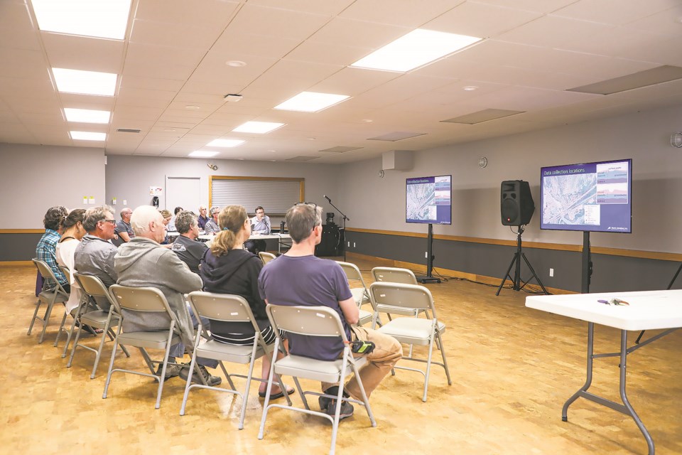
Near the three-year anniversary of groundwater swelling to unprecedented levels in the hamlet, an open house was held Tuesday (June 27) to discuss the findings of a study which found no evidence that flood mitigation work on Exshaw Creek was responsible for reports of up to 50 centimetres of groundwater swamping residences in 2020.
But the findings of Matrix Solutions’ report did little to mitigate the concerns of residents up to their elbows with flood issues over the years.
“What we’re substantially saying is that the design of the creek mitigation is not adequate and it’s caused us to have water that we didn’t have before, and you’d have a hard time proving to any of us with this report that isn’t the case,” Exshaw resident Ralph Anderson told Matrix staff at the open house.
The Matrix study assessed whether a sediment pond on Exshaw Creek – with the influence of storms, snowpacks, creeks and the Bow River – has exacerbated groundwater flooding in the community, particularly in east Exshaw.
Anderson’s home – like most in the hamlet – was damaged in the 2013 flood when Jura, Heart and Exshaw creeks overflowed, turning into raging rivers from heavy rainfall and a rapidly melting snowpack.
In 2020, Anderson’s home was inundated with water again; not by overland flooding or precipitation, but due to an unusually high snowpack melt that resulted in groundwater flooding in the basements and yards of numerous other residences.
The Matrix study shows the water table in Exshaw is rising, but likely due to a naturally increasing seasonal water table within the entire alluvial fan aquifer from rain and snowmelt.
The study aimed to identify factors causing groundwater flooding in Exshaw, including climate, hydrology, and hydrogeology. To accomplish this, an integrated surface water/groundwater model was used instead of a groundwater-only model.
Data was collected from 18 groundwater monitoring stations across the hamlet, most with data from 2020-22.
Matrix also established and monitored four temporary surface water stations, with two along Exshaw Creek, where water level data was collected during the 2022 high water season from May to September.
The study found the water table in east Exshaw is relatively high, especially east of Pigeon Mountain Drive where it is less than two metres below ground surface. It also found groundwater levels are highest between May and June from spring snowmelt and rainfall.
Modelling was performed based on climate information from 2010-22, topography, geology, land cover and boundaries, to close data gaps of groundwater conditions prior to the construction of the sediment pond and better understand potential impacts on groundwater elevations after construction.
“We developed a makeshift model and then we calibrated it to measure data to build trust in the model,” said Don Haley, senior groundwater scientist in charge of numerical modelling technical review on the study. “Then we used the model to do several predictive simulations."
“We looked at [groundwater levels] with and without the sedimentation pond and that showed very little difference between those results. That suggests to us that the sediment pond had little impact on the groundwater level.”
The findings are consistent with measured data, which reports the water table level was rising when there was no water in the sediment pond.
“So, there’s got to be some other recharge mechanism, which is contributing to those water levels rising when there’s no water in the pond,” Haley said.
The effect of other elements of the flood mitigation project such as the debris trap, channel armouring, and channel profile modifications – all upstream of the sediment pond – were not considered in the study, which it stated are factors that have a “negligible impact” on groundwater.
The MD of Bighorn hired Golder Associates to design the flood mitigation project, which involved digging the mountain creek deeper and wider to contain water flow.
Anderson said by not looking at the full scope of the project, too many questions are left unanswered. He and others believe, based on their experiences with flooding, that digging out the creek bed may have opened new groundwater channels leading beneath homes, instead of toward the river.
“When they did it they removed a bunch of surface and dug holes – a trench – and called it the creek,” he said. “Many of us believe that when they did that, they removed all the silt and caused the water to flow in a different direction.
“This report didn’t answer that question.”
Nathan Green, hydrogeologist and project manager of the groundwater study, said it was difficult for Matrix to get a sense of all the modifications that were made during the flood mitigation project.
“We’re looking only at the Golder design report,” he said. “So, it’s tough for us to see, in reality, what material was removed from the creek.”
Brian Thompson, who has lived in the Exshaw area since 1987, said water from the creek used to occasionally reach the Bow River prior to flood mitigation work, but hasn’t since.
It takes a substantial amount of water for the creek just to reach the sediment pond, he said, because water is “disappearing.”
“The only time it makes it to the sediment pond is when we have a huge rain event,” he said, adding that he walks along the creek almost daily. “There’s so many huge holes in that creek. [The water] just goes right under the bank.”
But data does not support groundwater recharge being higher at the creek post-construction, said Haley.
“What our model is suggesting is recharge from Exshaw Creek definitely has a strong influence close to the creek, but when we look at our existing conditions and pre-construction conditions, it doesn’t make that much of a difference,” he said. “What that tells me is these other recharge mechanisms are what’s driving this.”
Haley explained groundwater recharge can occur over top of the aquifer, through rain and melting snow, from along the toe of Exshaw Mountain as snowpack is being released, or from a rising creek affected by snowpack or rain.
“It’s not like Exshaw Creek is the only way for water to recharge that aquifer,” he said. “There’s multiple processes for how that happens.”
To address high groundwater levels and avoid future flooding, the Matrix study made recommendations to the MD based on modelled flood mitigation scenarios.
Flood mitigation through dewatering and sub-surface flow barriers was considered financially unfeasible due to the significant financial commitment required for what would need to be a large, municipal level pumping system.
Instead, the study suggested policy changes to mitigate the near-annual June basement flooding experienced by many Exshaw residents. Policies could include implementing groundwater flood mitigation measures in developments constructed in flood-prone areas, like restrictions on basement construction.
Exshaw Mountain Gateway, a residential development expected to add another 32-57 lots to north and east portions of the hamlet, will be built without basements.
MD of Bighorn Reeve Lisa Rosvold said the municipality will engage in discussions regarding policy changes in response to recommendations.
“That’s certainly one that administration will be looking at for future land use and bylaw amendments,” she said.
It was also recommended the MD continue monitoring the two wells immediately adjacent to Exshaw Creek to better understand real-time groundwater levels, annual changes, as well as to provide an early warning system for rising groundwater levels.
“We haven’t discussed that yet, but the recommendations have been brought back to administration to bring back more information to council,” said Rosvold.
The MD has previously disputed claims that Exshaw Creek flood mitigation is influencing the water infiltration in east Exshaw, however, Rosvold, who was a councillor at the time of the 2020 flood, said she is sympathetic to frustrations expressed by residents.
The study was presented to council last month, but she and others with the MD were at the open house to watch Matrix’s presentation and listen to discussions.
“I definitely heard from the public that they still feel that there’s questions that are unanswered, and I’m sympathetic to that and can understand their frustrations,” said Rosvold.
The next step is for administration to review the report’s recommendations and read back to council how some of those might be implemented, she added.
“We all need to try and figure out how we’re going to move forward and improve things.”


